Sunday, December 22, 2013

i-Pilot FOR POMPANO

Home in Port Charlotte
Lows 60s, highs 80s

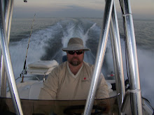
I fished the past 2 Saturdays and brought home tasty Pompano for dinners. 
Also caught a lot of Jack Cravelle and Bluefish.  Those aren't table fare for me but they sure are fun to fight and great practice for landing larger, in-shore, species.  For much of the morning, I was accompanied by some huge bottle nose dolphin, whose presence put a damper on the fishing. 

The trolling motor on my Mako flats boat has the new Minn Kota i-Pilot feature. It is a GPS enabled virtual anchor. Once I set it, it captures the longitude and latitude of my position and self adjusts to the current and wind to hold me within a few feet of that spot.  I have to say, it is absolutely amazing. 

I fished both days in a strong incoming tide, enhanced by the wide channel narrowing to a bridge opening, coupled with 10-15 mph winds.  The i-Pilot held my position and allowed me to concentrate on landing fish, not running the boat.  With my newly installed Power-Pole shallow water anchor system, I now have the tools I need to fish where I want to and (hopefully) catch what I want to. 

After I had my dinner secured in the fish box, I moved onto the mangrove channels in search of redfish but none were found this trip.  Nonetheless, accessing the skinny shallow flats just to get near the habitat is a fun adventure. 

These photos show the areas where I fished yesterday. 
Click on each one for full screen images. 

This first shot shows the Little Gasparilla Pass, where Placida Harbor meets the Gulf of Mexico.
The bridge I fished can be seen where the word Boca is listing the Boca Grande Causeway. 

This shot shows a wide angle of the Gulf Inter Coastal Waterway, along the Cape Haze peninsula. 
The barrier islands separate the ICW from the Gulf, seen left of the beach. 
I saw a huge manatee along this route yesterday. 
There are mangrove islands along along here, which can hold redfish at anytime...if you can find them. 

Every inshore channel in this photo was visited by my boat yesterday.  And every fish living there stayed well hidden from me.  Still, it was a beautiful tour of the sights and sounds of life on the barrier islands. 

Sunday, December 8, 2013

NICE DAY; NO LUCK

Home in Port Charlotte
High of 85*

Struck out yesterday.  Worked the east side between the keys and the sand bar from Alligator Creek to Pirate Harbor.  Had a pretty late start and was pleased to have made it behind the bar when the tide was already at .07 and falling.  Many crab traps were already exposed. 

After the turn of the tide I went out to the Jug Creek shoal and fished the grass flats. Saw a lot of activity from 2 to 245 but only hooked a puffer fish. Not sure what was chasing and feeding on the mullet but I tried 4 different lures and caught only grass. Tried top water, even though the sun was still high. Kept me out of the grass but no strikes. 

Went up Jog Creek for the first time...nice channel, looks like it would hold lots of redfish but I could find any.   Threw my spoon lure into the mangrove trees twice but was able to maneuver the little flats boat right to them and get it back.  (That was the luck of the day). 

Really the best news, besides the beautiful flat water and gorgeous weather, is that I filled my gas tank up yesterday morning before leaving home and found that my 3 previous fishing trips consumed a total of 9 gallons of fuel. My last boat would use 9 gallons of fuel in 3 hours, not three days.  Yet one more reason I'm glad I made the switch. 

Here's a couple photos on the water, taken at 35 MPH, running home.
Click on each picture for full screen. 

Click on picture too see full image


Below is a photo of where I fished.  Look at the right side and see the Keys listed from Silcox Key down to Crow Key.  You can see the long sand bar the runs the east wall of Charlotte Harbor.   Most days, the sand bar is a foot or two under water. Today, that sand bar was a peninsula.  At the bottom of the photo, you can see the Jug Creek shoal, directly beneath the letter k in Bokeelia Island.  That's about 20 miles from my house.  I've had good luck on sea trout there in the past but not today. 

Click on picture to see full image

Below is a close up of the Shoal, in the upper left-center.  Jug Creek can be seen as a narrow, winding channel, in the lower right, above Toms Bay. 
Click on picture to see full image