
Departing our home canal system

No we didn't buy too big a boat; someone built too small a bridge!

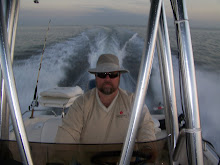
And we're Rollin'....Rollin'....Rollin on a river......

Hmmm...why didn't we look at real estate here?

Tied up at the Desoto Marina

Sign says, "You're either here or you're lost!"

This is traditional Old Florida

Hmmm...something here seems familiar.

Inside the confines of the Nav-A-Gator Grill

As we approached home, we found a boater who didn't have as good a day as us.
Home in Port Charlotte
High of 85, dry
Saturday afternoon we plotted a course up across Charlotte Harbor, eastbound and away from the Gulf, up the Peace River. This was a previously uncharted territory for this Captain and Crew but after researching our paper charts and Google Earth we were ready to go. Our launch was slightly delayed as we waiting until after 12 for the tide to bring us enough water to get off the lift. We launched at 12:20 PM. Once underway we found the harbor to be flat very lightly chopping. We had hoped to go pump out our blackwater tank but the late start forced us to postpone that for another day. As we crossed under the US 41 bridge we found the water of the Peace River to be as flat as glass.
Of course the river is very shallow and winding, so first timers must be very careful to follow a good and reliable chart. The appearance of the river water is deceiving and the main channel is quite narrow in some areas. I can best describe the route up the Peace as snaking. The deepest we found was 15 feet and at one point we slowed and raised the drives for a 3 foot shallow section. This is not to be undertaken during a falling tide.
Unbeknown to us as we approached the cove of our destination, the Desoto Marina, there was an unmarked sandbar. I saw another boat drifting in this area but didn't grasp that it was a "flats boat" that only needs about 9 inches of water to float. As we came through I was raising my out drive when suddenly my skeg (the lower rudder) was buried in sand and we came to a sudden stop. I continued raising the lower unit and was instantly freed from the grounding. It sure put a scare in us and the 34' Tiarra cruiser that was following us decided to take a different approach.
I raised the lower unit completely and performed a visual inspection. Thank goodness, all six blades of our prop were in place and undamaged. We continued the few hundred yards into the Desoto Marina and docked at a piling with the help of some local fishermen. These guys told me that the Tarpon run had begun, with both the river and the harbor full of the renowned Silver Kings. I was preoccupied with worrying about our boat. A thorough inspection of my skeg showed no damage. WHEW! Let's eat.
The Nav-a-gator Grill is situated on land that once served as a residential fish camp and prior to that was home to battles of the Seminole wars. It's a comfy, unassuming place, where bikers and boat captains dine next to snowbirds and euro-tourists. Everyone is welcome and the food is slow cooked to a high quality. Signage warns you that the food won't be fast but it will be good. There is seating inside and out, with an outdoor bandstand. If you're from Arizona you can relate by thinking of this as Rock Springs next to water.
I had the famous Super Grouper sandwich, blackened with Cajun seasonings on a hogi roll. Kathy had the Josh Burger, with Cajun seasonings, bacon, onion and cheese. Kathy upgraded from the fries to homemade kettle potato chips. Everything was wonderful. We each had bottomless iced tea and we spent $35 with tax and tip.
At 3:20PM we gave another check to the lower unit and left feeling confident. We were concerned about time because the tide required us to be at the bad bridge no later than 4:45. Coming down the Peace River, I was disappointed that we had to run and gun in a race against the clock. I vowed we would return and slow down to see the fish and gators next time. After passing back under the US 41 bridge we went with wide open throttle and cruised at 35 knots. The afternoon winds in the harbor had picked up slightly but they were head on so we weren't tossed about.
This was Kathy's first time aboard since we installed a stereo system after Christmas and she enjoyed Kenny Chesney's CD, Lucky Old Sun. We arrived at the bad bridge 10 minutes ahead of schedule and carefully passed under with the tide at 1.1 feet about mean level. Our critical high limit is 1.2. We need 0.8 to come and go from the lift. On the way home, Kathy photographed a boat about a mile from our house that had a large pine tree fall on it, smashing the bimini top. Sucks to be them. Anyone remember the huge Australian Pine we had removed from our canal last summer? Exhibit A shows why that was smart.
It was a quick trip but nonetheless enjoyable. This will help me get through my trip to Washington DC with fresh memories of rollin' on the Peace River and Messing About in South Florida.
Trip meter: 36 miles travelled, 3 hours run time, average moving speed 11 knots, peak speed 35 knots. Hour meter 378.5
No comments:
Post a Comment